Supporting archaeological excavation planning with Stream X
Large-scale non-destructive analysis of underground structures at the archaeological site of Pyrgi

The use of GPR (Ground Penetrating Radar) data acquisition for archaeological purposes has been known for many years and is used in a variety of applications. Archaeology and the cultural heritage benefit greatly from reliable and non-destructive analysis, to map underground structures without the need for excavation. IDS GeoRadar portfolio of solutions provides non-intrusive ground penetrating solutions delivering detailed and accurate information on underground areas. The maps generated show the presence and shape of buried objects, providing archaeologists with useful information to identify excavation sites.
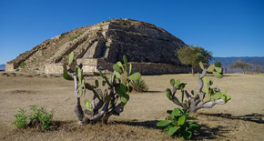
This acquisition project was carried out at Pyrgi, an important ancient Etruscan port city located near the Tolfa Mountains, municipality of Santa Marinella - 60 km north of Rome, Italy. This archaeological settlement extends approximately for 10 hectares.
Stream X an extensive 3D mapping of buried structures
Due to the extension of the archaeological area, archaeologists carried out a 3D reconstruction approach of the underground structures leveraging an advanced IDS GeoRadar GPR system, Stream X.
The Stream X system is a GPR device for extensive 3D mapping of buried structures and geologic features, capable of acquiring 2 metres of surface in a single swath. It boasts a two-module antenna with 16 channels spaced 12 centimetres apart. The array is in VV polarisation (the dipoles are parallel to the scanning direction) and the central frequency of the system is 200 MHz. The entire system having a large scanning footprint enables true 3D acquisition in every rugged extended survey area.
The underground analysis carried out with Stream X confirmed GPR data as a fundamental tool for non-invasive 3D mapping of underground structures and this technology as the future for archaeological excavation planning reducing costs and environmental impact of Archaeological surveying.
Download the Use Case


