Supporting archaeological excavation planning with Stream X
Underground large-scale non-destructive analysis of underground structures at the archaeological site of Pyrgi

The use of GPR (Ground Penetrating Radar) data acquisition for archaeological purposes has been known for many years and is used in a variety of applications. Archaeology and the cultural heritage benefit greatly from reliable and non-destructive analysis, to map underground structures without the need for excavation. IDS GeoRadar portfolio of solutions provides non-intrusive ground penetrating solutions delivering detailed and accurate information on underground areas. The maps generated show the presence and shape of buried objects, providing archaeologists with useful information to identify excavation sites.
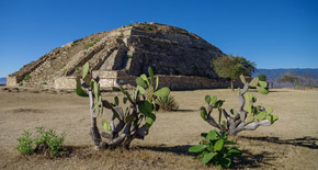
This acquisition project was carried out at Pyrgi, an important ancient Etruscan port city located near the Tolfa Mountains, municipality of Santa Marinella - 60 km north of Rome, Italy. This archaeological settlement extends approximately for 10 hectares.
Stream X, an extensive 3D mapping of buried structures
Due to the extension of the archaeological area, archaeologists carried out a 3D reconstruction approach of the underground structures leveraging an advanced IDS GeoRadar GPR system, Stream X. The Stream X system is a GPR device for extensive 3D mapping of buried structures and geologic features, capable of acquiring 2 metres of surface in a single swath. It boasts a two-module antenna with 16 channels spaced 12 centimetres apart. The array is in VV polarisation (the dipoles are parallel to the scanning direction) and the central frequency of the system is 200 MHz. The entire system having a large scanning footprint enables true 3D acquisition in every rugged extended survey area.
The survey area consisted in over 9.000 square metres. The data acquisition phase took less than three hours to complete and was carried out using the on-field One Vision software, which also allowed navigation using the GNSS system for positioning during the survey, resulting in accurate coverage of the survey area.
Stream X, data processing and results
Once the data for the entire survey area had been collected, it has been imported into the IDS GeoRadar’s GRED HD post-processing software. This tool allows the data acquired with Stream X to be properly filtered and interpreted through a dedicated CAD toolbar.
After radar data processing, the results are clearly displayed in 3D and shown in terms of time-slices to facilitate data analysis and archaeological interpretation. Stream X detected anomalies at different depths. The three-dimensional image cube of the GPR data was used to extract depth slices for data interpretation. Slices at depths of 20cm, 40cm , 80cm and 1m below ground level were the most suitable to describe the archaeological layer of the Pyrgi site.
Archaeologists were able to map underground structures and interpret the GPR post-processed data in archaeological terms, the anomalies detected by time-slice drew a clear map of antropic underground elements.
Conclusions
Stream X acquisition and GRED HD post-processing were extremely useful for archaeological interpretation as they highlighted the presence of structures at different heights and provided preliminary information on the main building interventions and planimetric changes within the urban plots.
The underground analysis carried out with Stream X confirmed GPR data as a fundamental tool for non-invasive 3D mapping of underground structures and this technology as the future for archaeological excavation planning reducing costs and environmental impact of Archaeological surveying.
BIBLIOGRAPHY: This work is published by Wiley in:
- Luciana Orlando, Laura M. Micheletti, Barbara Belelli Marchesini, Paolo Papeschi, Fabio Giannino. "Dense georadar survey for a large-scale reconstruction of the archaeological site of Pyrgi (Santa Severa, Rome)", Archaeological Prospection, Volume 26, Issue4 October/December 2019 Pages 369-377
- Fabio Giannino and Giovanni Leucci, 2021: Electromagnetic Methods in Geophysics Applications in GeoRadar, FDEM, TDEM, and AEM, First Ed. 2022, John Wiley & Sons, Inc


