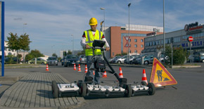
Utility detection for avoidance and mapping
Uncovering Data, Digitalise Reality


Cable avoidance
Undertaking any excavation will inevitably bring site workers into close proximity to underground utilities. Consideration should always be given to knowing the exact location of all buried utilities before and during the excavation process.
DD SMART Utility Locators Solution
How to locate utilities – 6 levels of utility detection
How cable locators work – Principles of buried utility detection

Competition
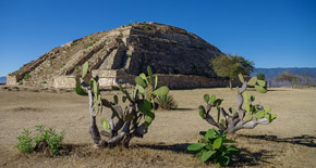
Identify the landmark below for your chance to win a HTC VIVE virtual reality headset. Visit each week for a chance to enter the prize draw*.
How to choose your utility detection instrument?
Leica DX Manager Mapping

Utilities Detection and Mapping
A utility map shows the positioning and identification of buried pipes and cables beneath the ground. Combine mapping process with a topographical survey and the results will provide you with a comprehensive detailed map of utilities.

Extensive 3D utility mapping
An extensive utility detection and mapping process allow an accurate and complete recording of underground utility assets reducing the risk of third-party damage. The use of multi-frequency and multi-channel radar technology, permits to scan and map all the underground assets both in narrow and extensive areas with a fast and easy process with very high accuracy and significant resource reductions.
uMap
IQMaps
IQMaps is a new post-processing software application for advanced GPR data analysis, which provides a fast interfacing between the user and the GPR data. Machine time has been reduced and, contemporarily, real-time processing, advanced target management and 3D visualization have been introduced.
IQMaps is a new post-processing software application for...

Above and Underground 3D Mapping
What's happening underground affects what's happening above ground. With 3D visualisation underground with GPR and above ground with laser scanning, extensively know any environment to make the best informed decisions.


